General
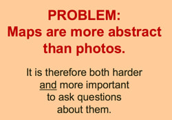
Article: What Do We Mean by Reading Maps?
Global Schoolhouse - The Global Schoolhouse is a virtual meeting place where kids from all over the world can work and learn together.
The Best Videos For Learning Why It’s Important To Study Geography
Digitally Writing New Histories” Unit Plans. (gr. 3 - 12) With a shift towards disciplinary, digital, and critical literacies, with historical documents and artifacts — as well as images, social media posts, and videos created with contemporary technologies — all serve as primary sources for inquiry-based, learning.
Websites For Learning & Teaching Geography
Open Geography Curriculum and Resources Free curriculum for teaching that most necessary of subjects, geography. A solid knowledge of geography provides an understanding of politics and culture. It grants a sense of perspective to understand the map.
Juxtapose JS is a free visual tool that can help people make comparisons between images. Having a tool like Juxtapose can help us visualize the spatial organization and relationship between spaces and buildings over time. This can raise interesting questions about why something changed or stayed the same. How do spatial patterns influence a person’s or a community’s interactions with the landscape and with other communities?
Geo-Inquiry Process Geo-Inquries are designed to help students understand how the complex and dynamic human and natural systems interact in order to help them make smart decisions. Using both “a geographic perspective and the Geo-Inquiry Process students begin to connect complex components, see patterns, and make connections that change their communities.
Why every world map is wrong - video
5 Ways to Tell Stories With Maps
StoryMapJS is a web-based digital tool for designing stories that make significant use of maps. It was designed for journalists but can be adapted for classroom use. In terms of project possibilities, students could create journeys, travel guides, historical fiction, nonfiction, news stories -- pretty much anything that relies on or benefits from maps. Creating a story is kind of like a hybrid of a slideshow and an interactive map. Students string together a series of slides where they can add text and then link map locations, images, and video to support the story.
World Atlas 2.0, You can click on any one of nearly 3,000 different data sets related to technology, population, education, etc, and a visual representation of it will show up on a world map.
The “Phersu Atlas” Claims To Provide A Day-By-Day History Of The World
Data Atlas of the World a service that provides many different information-dense maps, the Data Atlas of the World may be a good choice. The maps included on this site are built in Adobe Illustrator with data imported from Microsoft Excel. The maps and visualizations are produced by Carrie Osgood, a Pulitzer Prize-nominated visual data journalist and professor.
ArcGIS Living Atlas of the World is a collection of thousands of online, interactive maps representing all kinds of data. The contents of the collection range from relatively simple displays of historical map imagery to complex, displays of data updated nearly live. For example, this map displays active hurricanes, cyclones, and typhoons. Another good example is this map that displays current air quality conditions around the world. www.freetech4teachers.com
The Best Tools For Comparing Demographics Of Different Countries.
Color Land Form Atlas of the United States
Contains topographical and political maps from states to counties
World Data Atlas
Chrome app for data and visualizations for countries and regions.
Elementary Geography Kit
US History Geography Kit
World History Geography Kit
Article - Why Your Mental Map of the World is (Probably) Wrong Most of our mental maps are wrong. And there are some pretty good reasons for that. But it’s an interesting article because it reinforces the need for the intentional integration of geography into our social studies instruction
Geography Now This is a YouTube channel where you can access informative video content on almost all the countries of the world. You can use these videos with students to introduce them to the cultures, geography and traditions of other countries. Videos in the playlist are organized alphabetically based on the first letter of the country.
Video: “The Largest Cities Throughout History: Every Year”
Google Earth
Geography Hub. Video Channel. it targets interesting Geography-related questions.
10 Maps That Will Change the Way You See the World Video
Online Resources for Teaching IB DP Geography is a free iBook published by Richard Allaway. The free iBook contains sixteen chapters addressing sixteen topics in the geography theme of "patterns and change." Within each chapter you will find a featured online resource and suggestions for using it to teach the topic of the chapter.
Your Life On Earth is a feature of the BBC's Earth website. Your Life On Earth shows you how the world has changed during your lifetime. Enter your birthdate and Your Life On Earth will show you things like how much the world's population has grown, how many new species have been discovered, and how many earthquakes and volcanic eruptions have occurred since you were born.
All Over the Map, National Geographic's new geography focused blog.
My Wonderful World
A campaign by NGS to expand geographic learning in school, at home, and in the community. Lots of goodies!
mapFAST is a unique use of Google Maps for finding texts about places all over the world. Visit mapFAST, type in a location and mapFAST will generate a list of texts about that location.
National Geographic Learning National Geographic has a long history of providing teachers with excellent learning resources. Today, teachers can explore their resource library, their library of interactive maps, and teachers can even make their own interactive
maps! The resource library has thousands of lessons, activities, articles, and more - all of which can be shared directly to Google Classroom or Microsoft Teams.
National Geographics
Includes resources on people, cultures, history, animals, and places. National Geographic recently unveiled a new education section for students and teachers.
Xpeditons
Maps, lessons and virtual trips from National Geographic.
Go Social Studies Go
essentially a series of multimedia books about common social studies topics. The site is divided into four main sections; World Geography, World Religions, Ancient History, and Colonial America. Within each section is a series of booklets containing text, pictures, videos, and links to additional resources.
Timelapse is an incredible visual satellite timeline powered by Google. Timelapse is about as close as you can get to a time machine, if that time machine hovered above the earth and gave you a bird’s eye view of development and change. Students can choose from some highlighted Timelapse views including: Las Vegas, Dubai, Shanghai, Oil Sands, Mendenhall Glacier, Wyoming Coal, Columbia Glacier, and Lake Urmia. Alternatively, students can use the search box to view a satellite timelapse of any place in the world. Students can change the speed of the timelapse, pause the satellite imagery, and zoom in or zoom out. The imagery begins in 1984 and goes through 2012.
Timelapse The site itself sparks lots of questions. Depending on the location, students may inquire into climate change, history, development, expansion, human impact on land, satellites, etc. Timelapse could also be used in science classes and history classes. This is a great tool for students to use to analyze and evaluate visual data.
Geography World
Links to everything on the web a geography teacher (cultural or physical) should need. A great find was the links to Maps and Globes, with lots of links to maps and a link to Map Jokes (with Map Haiku also at that website). World regions are represented with many links that could benefit students researching individual countries.
Manifest Destiny - The Story of The U.S. Told in 141 Maps is a website developed by Michael Porath. As you probably guessed from the title of this blog post, the site features 141 interactive maps chronicling the expansion of the United States from March 1789 to August 1959. When you click on any of the maps you will see the new territories acquired in that year and month. Each map is accompanied by a brief description of how the new territories were acquired. www.freetech4teachers.com
MappingWorlds
the site offers users a new way to look at the world by resizing countries on the map in relation to a series of global issues.
Worldometers
A site that constantly updates world data on population, economics, education, environment, etc
World Population History Map - Interactive map that shows world population over time, along with informational milestones.
World Atlas 2.0, you can click on any one of nearly 3,000 different data sets related to technology, population, education, etc, and a visual representation of it will show up on a world map.
The Best Tools For Comparing Demographics Of Different Countries.
Zip Lookup The map allows you to enter any US zip code to discover demographic data about that area.The site will give you graphs of the demographic data for a zip code. It will also give you a little blurb about what the data graphs mean in terms of the characteristics of the town or city represented by the data. Zip Lookup could be a tool for students to use to discover how people in other parts of their counties, states, or country live.
Worldvuze - Take some time to explore this map-based question and answer education platform where elementary and secondary students around the world can learn directly from each other!
Animated Infographic: “Top 20 Country Population History & Projection (1810-2100)”
MapsofWorld
A comprehensive infographic that posed a thought-provoking question on a global topic. The Fry-Day Poll Infographics sparked many conversations and often appeared on Slideshare’s top featured presentations. This is a page listed all 100 of their polls
Portals to the World
Maintained by the US Library of Congress & contains selective links providing authoritative, in-depth information about different nations of the world
US Geological Survey’s Learning Web
Provides activities, maps, and teacher guides, it also has student pages and lesson plans
Map Machine @ nationalgeographic.com
Find nearly any place on Earth and view it by population, climate, and much more
United Nations CyberSchoolBus
Wonderful resource full of data, maps, lesson plans, games, quizzes, multi-media resources, CDs, video clips, documents, student work from around the world, you name it, it is here
360Cities We are the web's largest and fastest growing collection of interactive panoramic images from around the world.
Gapminder
Tons of authentic data from the UN. Site is interactive and the data is amazing and visually easy to interpret!
Geography week Use this resource pack, which includes activity suggestions and assembly templates, to assist you when planning a geography-themed week at your school.
Primary geography resources Our detailed geography guide is full of resources, activities and lesson plans aligned to each objective of the 2014 national curriculum.
Weather planning Save time preparing for a weather-themed lesson with this comprehensive plan, which looks at types of weather, weather in different countries and forecasting.
Flooding mystery activity Cut up and distribute these activity cards, then students work through the clues to identify the causes and effects of the Somerset floods.
Geography questions Improve pupils' enquiry skills with this PowerPoint presentation of key geographical questions, which could be used as a display in your classroom.
WFP Food Force gr 6 -12
This learning-oriented site is sponsored by the UN's World Food Programme and seeks to teach students about world hunger: its causes, its impact, and world-wide efforts to help. While the focus of the site is on a downloadable video game, there are a number of other great resources for teachers to use in teaching about world hunger. There is a Flash animated program called Counting the Hungry that gives a good, although pretty grim, overview. There are lesson plans and photo galleries and links to outside resources.
Climate Change Issues
Learn about global environmental, climate, and political problems. This is your source for background information and environmental and political geography.
Places in the News provides historical context and geography resources for current events.
Sinai
Explore this historic desert land that is Egypt's border with Israel. Meet the Bedouin inhabitants, tour amazing sites, dive its coral reefs, and discover why it is considered a holy and sacred land for so many.
Geography4Kids.com
Geography4Kids.com is a website that teaches the basics of physical geography and earth sciences. It has sections on earth energy, earth structure, the atmosphere, climates, and much more.
topoView is a free service that anyone can use to find and download historical topographic maps produced by the USGS since 1880. www.freetech4teachers.com
Lonely Planet
Has some incredibly useful geography resources and information. Blogs from around the world giving up-to-date information on their travel experiences & a neat tool called WorldGuide.
National Council for Geographic Education K-12
Current news, subscription magazine and free activities in the Geogrpahy Club.
Maps from National Geographic Xpeditions Grades 4 to 12
Here's an interactive resource that lets you find and print maps of just about any country. The final results are available as GIF or Adobe Acrobat files, and the site offers links to additional information on geography and cultures.
Oxfam's Cool Planet for Teachers 6-12
Oxfam's Teacher Resource site contains a wealth of information about global issues and human rights. There are lesson plans on fair trade, social justice, sustainability, and a new unit on global music. Given the nature of the issues explored, there is a special teacher's guide to teaching controversial issues. The link to "Mapping our World" takes you to a great interactive look at the world and the impact of maps on our view of the world.
Hot Zones - PBS
Part of the PBS series "Journey to Planet Earth," "Hot Zones" explores how changes in ecosystems can lead to increased risk and transmission of infectious diseases. Includes video clips and educational resources.
Adventure Learning Foundation Grades 6 to 12
This searchable site provides resources for teaching geography and culture. Currently, the page’s "expeditions" are limited to Baja California, American Southwest, Southern Africa, Oaxaca Mexico, and Peru.
USGS and Science Education
U.S. Geological Survey provides scientific information intended to help educate the public about natural resources, natural hazards, geospatial data, and issues that affect our quality of life. This website provides links to selected online resources to support education and research.
Geo-Mystery
Internet project in which students choose a unique place somewhere in their town, take pictures, and post a description of the unique place. Based on the clues that students provide, other students try to figure out where the location is. It is a great way to apply geography and analytical thinking skills.
National Geographic Xpedition: Stormy Stories
At this site from the National Geographic Soceity, students will read four stories from children at various locations in the world. From the data given the students will then try to determine which story corresponds to each of the locations.
Internet Resources for Geography and Geology
Choose from a dozen topics including world geography, government resources, and teaching helps. Link to environmental information or take a virtual tour of Bosnia, Hawaii, the Grand Canyon, others.
Terra the EOS Flagship gr 6-12
Terra is an Earth Observing System designed by NASA to monitor, measure, and protect the Earth's environment and climate system. This site contains breathtaking, up-to-date satellite images of our planet, and interactive experiments that can be done in the classroom
Desert USA Magazine
This site is attractive and well organized, offers comprehensive information on the geography, plants, animals, and people of the desert, especially the desert of the American Southwest. Published online monthly with back issues archived, DesertUSA has features, desert adventures (including park, climbing, and camping information), desert talk, a trading post, and more. Great stuff!
Very Spatial Podcast
Very Spatial continues to impress by getting people ranging from academics to employees of National Geographic to update us on the advancement of geography itself.
The Best Videos For Learning Why It’s Important To Study Geography
Digitally Writing New Histories” Unit Plans. (gr. 3 - 12) With a shift towards disciplinary, digital, and critical literacies, with historical documents and artifacts — as well as images, social media posts, and videos created with contemporary technologies — all serve as primary sources for inquiry-based, learning.
Websites For Learning & Teaching Geography
Open Geography Curriculum and Resources Free curriculum for teaching that most necessary of subjects, geography. A solid knowledge of geography provides an understanding of politics and culture. It grants a sense of perspective to understand the map.
Juxtapose JS is a free visual tool that can help people make comparisons between images. Having a tool like Juxtapose can help us visualize the spatial organization and relationship between spaces and buildings over time. This can raise interesting questions about why something changed or stayed the same. How do spatial patterns influence a person’s or a community’s interactions with the landscape and with other communities?
Geo-Inquiry Process Geo-Inquries are designed to help students understand how the complex and dynamic human and natural systems interact in order to help them make smart decisions. Using both “a geographic perspective and the Geo-Inquiry Process students begin to connect complex components, see patterns, and make connections that change their communities.
Why every world map is wrong - video
5 Ways to Tell Stories With Maps
StoryMapJS is a web-based digital tool for designing stories that make significant use of maps. It was designed for journalists but can be adapted for classroom use. In terms of project possibilities, students could create journeys, travel guides, historical fiction, nonfiction, news stories -- pretty much anything that relies on or benefits from maps. Creating a story is kind of like a hybrid of a slideshow and an interactive map. Students string together a series of slides where they can add text and then link map locations, images, and video to support the story.
World Atlas 2.0, You can click on any one of nearly 3,000 different data sets related to technology, population, education, etc, and a visual representation of it will show up on a world map.
The “Phersu Atlas” Claims To Provide A Day-By-Day History Of The World
Data Atlas of the World a service that provides many different information-dense maps, the Data Atlas of the World may be a good choice. The maps included on this site are built in Adobe Illustrator with data imported from Microsoft Excel. The maps and visualizations are produced by Carrie Osgood, a Pulitzer Prize-nominated visual data journalist and professor.
ArcGIS Living Atlas of the World is a collection of thousands of online, interactive maps representing all kinds of data. The contents of the collection range from relatively simple displays of historical map imagery to complex, displays of data updated nearly live. For example, this map displays active hurricanes, cyclones, and typhoons. Another good example is this map that displays current air quality conditions around the world. www.freetech4teachers.com
The Best Tools For Comparing Demographics Of Different Countries.
Color Land Form Atlas of the United States
Contains topographical and political maps from states to counties
World Data Atlas
Chrome app for data and visualizations for countries and regions.
Elementary Geography Kit
US History Geography Kit
World History Geography Kit
Article - Why Your Mental Map of the World is (Probably) Wrong Most of our mental maps are wrong. And there are some pretty good reasons for that. But it’s an interesting article because it reinforces the need for the intentional integration of geography into our social studies instruction
Geography Now This is a YouTube channel where you can access informative video content on almost all the countries of the world. You can use these videos with students to introduce them to the cultures, geography and traditions of other countries. Videos in the playlist are organized alphabetically based on the first letter of the country.
Video: “The Largest Cities Throughout History: Every Year”
Google Earth
- I'm Feeling Lucky - Around the World With Google Earth the web version of Google Earth has numerous features that can help students learn about the world. One of those neat features is the "I'm Feeling Lucky" button that is found on the left hand toolbar in Google Earth. Clicking that button will take students to a randomly-selected place in the world. On its own the "I'm Feeling Lucky" button provides a good way for students to discover new places. That said, students learn more through the "I'm Feeling Lucky" button if you give them a little more direction than just "click the button and look around." Here is a question sheet to prompt students to do a little research about the places they discover in Google Earth via "I'm Feeling Lucky." My question sheet can be found here as a Google Doc. This short video demonstrates how students can explore Google Earth in more detail after clicking "I'm Feeling Lucky." www.freetech4teachers.com
- Google 3D Timelapse Feature for Observing Planet EarthTimelapse in Google Earth combines more than 24 million satellite photos, two petabytes of data, and 2 million hours of CPU processing time to create an interactive view showing how Earth has changed from 1984 to 2020. Users can choose practically any place on Earth, change camera angles, and select a specific year they want to see. They can access Timelapse in Google Earth simply by going to g.co/Timelapse, or by tapping the Ship’s Wheel icon in Google Earth and selecting “Timelapse.” Google has provided more than 200 spotlights and guided tours for specific locations,
- GE Teach is built around the Google Earth browser plug-in. The purpose of the site is to help teachers develop lessons in which students explore spatial distributions. Visitors to GE Teach can select from a variety of physical geography and human geography layers to display and explore. A fantastic feature of GE Teach is the option use the "two Earths" mode to show two maps side-by-side. The "two Earths" mode could be useful for prompting students to make comparisons and or correlations between two maps. video tutorial
- GE Teach - Make Side-by-Side Map Comparisons in One Browser On GE Teach students can compare two maps side-by-side. Students can select from gallery of map layers to compare side-by-side in GE Teach. In addition to comparing maps students can use drawing and measuring tools that you would typically find in Google's My Maps and Earth tools. GE Teach provides a great way for students to compare data sets in a map environment. That comparison allows students to try to make correlations between energy use and population centers. A bonus of GE Teach is that your students can enable the drawing and measuring tools without having to sign into a Google Account. www.freetech4teachers.com
- Three Ways to Collaboratively Create Multimedia Maps With Padlet's new multimedia mapping tool and the recent update to the web version of Google Earth there are more ways than ever for students to collaborate on creating multimedia maps. The three collaborative multimedia mapping tools that I'm going to recommend to most people for the foreseeable future are Google's My Maps, Padlet, and the web version of Google Earth. Tutorials for all three Padlet map. My Maps Google Earth
- Math and Geography Thomas Petra has a Google Earth resource that he developed. The resource is Real World Math. It has many Google Earth files on it that you can download to use as the basis of real world math problems. Real World Math has lesson plans divided into five categories; project-based learning, concept lessons, measurement lessons, exploratory lessons, and space lessons. The space lessons take advantage of the Moon, Mars, and Sky views in Google Earth. www.freetech4teachers.com
- Tom Barrett's Maths Maps is series of activities designed to help elementary school students develop an understanding of distance, scale, and units of measurement. To complete the activities students have to use the measuring tool in Google Maps. This video demonstrates how to measure distances in the web browser version of Google Maps. www.freetech4teachers.com
- Create Your Own Maps & Stories On Google Earth is from Google.
- Thematic Mapping Engine provides users with a very simple way to create Google Earth kmz files. Thematic Mapping draws on data provided by the United Nations to create maps depicting all types of development data and environmental science data. Users select a statistical indicator category, select a year or range of years, and the manner in which they would like the data displayed in Google Earth. If you're using a Windows computer you can preview your files before downloading them.
- Google Maps. Here’s a useful tutorial.
- Video - How to Download Google Maps www.freetech4teachers.com
- Three Ways to Share Google Maps Views in Google Classroom www,freetech4teachers.com
- MapTiler MapTiler is graphical application for online map publishing. Your map can create overlay of standard maps like Google Maps, Yahoo Maps, Microsoft VirtualEarth or OpenStreetMap and can be also visualized in 3D form by Google Earth. Only thing you have to do for publishing the map is to upload the automatically generated directory with tiles into your web server.
Geography Hub. Video Channel. it targets interesting Geography-related questions.
10 Maps That Will Change the Way You See the World Video
Online Resources for Teaching IB DP Geography is a free iBook published by Richard Allaway. The free iBook contains sixteen chapters addressing sixteen topics in the geography theme of "patterns and change." Within each chapter you will find a featured online resource and suggestions for using it to teach the topic of the chapter.
Your Life On Earth is a feature of the BBC's Earth website. Your Life On Earth shows you how the world has changed during your lifetime. Enter your birthdate and Your Life On Earth will show you things like how much the world's population has grown, how many new species have been discovered, and how many earthquakes and volcanic eruptions have occurred since you were born.
All Over the Map, National Geographic's new geography focused blog.
My Wonderful World
A campaign by NGS to expand geographic learning in school, at home, and in the community. Lots of goodies!
mapFAST is a unique use of Google Maps for finding texts about places all over the world. Visit mapFAST, type in a location and mapFAST will generate a list of texts about that location.
National Geographic Learning National Geographic has a long history of providing teachers with excellent learning resources. Today, teachers can explore their resource library, their library of interactive maps, and teachers can even make their own interactive
maps! The resource library has thousands of lessons, activities, articles, and more - all of which can be shared directly to Google Classroom or Microsoft Teams.
National Geographics
Includes resources on people, cultures, history, animals, and places. National Geographic recently unveiled a new education section for students and teachers.
Xpeditons
Maps, lessons and virtual trips from National Geographic.
Go Social Studies Go
essentially a series of multimedia books about common social studies topics. The site is divided into four main sections; World Geography, World Religions, Ancient History, and Colonial America. Within each section is a series of booklets containing text, pictures, videos, and links to additional resources.
Timelapse is an incredible visual satellite timeline powered by Google. Timelapse is about as close as you can get to a time machine, if that time machine hovered above the earth and gave you a bird’s eye view of development and change. Students can choose from some highlighted Timelapse views including: Las Vegas, Dubai, Shanghai, Oil Sands, Mendenhall Glacier, Wyoming Coal, Columbia Glacier, and Lake Urmia. Alternatively, students can use the search box to view a satellite timelapse of any place in the world. Students can change the speed of the timelapse, pause the satellite imagery, and zoom in or zoom out. The imagery begins in 1984 and goes through 2012.
Timelapse The site itself sparks lots of questions. Depending on the location, students may inquire into climate change, history, development, expansion, human impact on land, satellites, etc. Timelapse could also be used in science classes and history classes. This is a great tool for students to use to analyze and evaluate visual data.
Geography World
Links to everything on the web a geography teacher (cultural or physical) should need. A great find was the links to Maps and Globes, with lots of links to maps and a link to Map Jokes (with Map Haiku also at that website). World regions are represented with many links that could benefit students researching individual countries.
Manifest Destiny - The Story of The U.S. Told in 141 Maps is a website developed by Michael Porath. As you probably guessed from the title of this blog post, the site features 141 interactive maps chronicling the expansion of the United States from March 1789 to August 1959. When you click on any of the maps you will see the new territories acquired in that year and month. Each map is accompanied by a brief description of how the new territories were acquired. www.freetech4teachers.com
MappingWorlds
the site offers users a new way to look at the world by resizing countries on the map in relation to a series of global issues.
Worldometers
A site that constantly updates world data on population, economics, education, environment, etc
World Population History Map - Interactive map that shows world population over time, along with informational milestones.
World Atlas 2.0, you can click on any one of nearly 3,000 different data sets related to technology, population, education, etc, and a visual representation of it will show up on a world map.
The Best Tools For Comparing Demographics Of Different Countries.
Zip Lookup The map allows you to enter any US zip code to discover demographic data about that area.The site will give you graphs of the demographic data for a zip code. It will also give you a little blurb about what the data graphs mean in terms of the characteristics of the town or city represented by the data. Zip Lookup could be a tool for students to use to discover how people in other parts of their counties, states, or country live.
Worldvuze - Take some time to explore this map-based question and answer education platform where elementary and secondary students around the world can learn directly from each other!
Animated Infographic: “Top 20 Country Population History & Projection (1810-2100)”
MapsofWorld
A comprehensive infographic that posed a thought-provoking question on a global topic. The Fry-Day Poll Infographics sparked many conversations and often appeared on Slideshare’s top featured presentations. This is a page listed all 100 of their polls
Portals to the World
Maintained by the US Library of Congress & contains selective links providing authoritative, in-depth information about different nations of the world
US Geological Survey’s Learning Web
Provides activities, maps, and teacher guides, it also has student pages and lesson plans
Map Machine @ nationalgeographic.com
Find nearly any place on Earth and view it by population, climate, and much more
United Nations CyberSchoolBus
Wonderful resource full of data, maps, lesson plans, games, quizzes, multi-media resources, CDs, video clips, documents, student work from around the world, you name it, it is here
360Cities We are the web's largest and fastest growing collection of interactive panoramic images from around the world.
Gapminder
Tons of authentic data from the UN. Site is interactive and the data is amazing and visually easy to interpret!
Geography week Use this resource pack, which includes activity suggestions and assembly templates, to assist you when planning a geography-themed week at your school.
Primary geography resources Our detailed geography guide is full of resources, activities and lesson plans aligned to each objective of the 2014 national curriculum.
Weather planning Save time preparing for a weather-themed lesson with this comprehensive plan, which looks at types of weather, weather in different countries and forecasting.
Flooding mystery activity Cut up and distribute these activity cards, then students work through the clues to identify the causes and effects of the Somerset floods.
Geography questions Improve pupils' enquiry skills with this PowerPoint presentation of key geographical questions, which could be used as a display in your classroom.
WFP Food Force gr 6 -12
This learning-oriented site is sponsored by the UN's World Food Programme and seeks to teach students about world hunger: its causes, its impact, and world-wide efforts to help. While the focus of the site is on a downloadable video game, there are a number of other great resources for teachers to use in teaching about world hunger. There is a Flash animated program called Counting the Hungry that gives a good, although pretty grim, overview. There are lesson plans and photo galleries and links to outside resources.
Climate Change Issues
Learn about global environmental, climate, and political problems. This is your source for background information and environmental and political geography.
Places in the News provides historical context and geography resources for current events.
Sinai
Explore this historic desert land that is Egypt's border with Israel. Meet the Bedouin inhabitants, tour amazing sites, dive its coral reefs, and discover why it is considered a holy and sacred land for so many.
Geography4Kids.com
Geography4Kids.com is a website that teaches the basics of physical geography and earth sciences. It has sections on earth energy, earth structure, the atmosphere, climates, and much more.
topoView is a free service that anyone can use to find and download historical topographic maps produced by the USGS since 1880. www.freetech4teachers.com
Lonely Planet
Has some incredibly useful geography resources and information. Blogs from around the world giving up-to-date information on their travel experiences & a neat tool called WorldGuide.
National Council for Geographic Education K-12
Current news, subscription magazine and free activities in the Geogrpahy Club.
Maps from National Geographic Xpeditions Grades 4 to 12
Here's an interactive resource that lets you find and print maps of just about any country. The final results are available as GIF or Adobe Acrobat files, and the site offers links to additional information on geography and cultures.
Oxfam's Cool Planet for Teachers 6-12
Oxfam's Teacher Resource site contains a wealth of information about global issues and human rights. There are lesson plans on fair trade, social justice, sustainability, and a new unit on global music. Given the nature of the issues explored, there is a special teacher's guide to teaching controversial issues. The link to "Mapping our World" takes you to a great interactive look at the world and the impact of maps on our view of the world.
Hot Zones - PBS
Part of the PBS series "Journey to Planet Earth," "Hot Zones" explores how changes in ecosystems can lead to increased risk and transmission of infectious diseases. Includes video clips and educational resources.
Adventure Learning Foundation Grades 6 to 12
This searchable site provides resources for teaching geography and culture. Currently, the page’s "expeditions" are limited to Baja California, American Southwest, Southern Africa, Oaxaca Mexico, and Peru.
USGS and Science Education
U.S. Geological Survey provides scientific information intended to help educate the public about natural resources, natural hazards, geospatial data, and issues that affect our quality of life. This website provides links to selected online resources to support education and research.
- Learning From Home With USGS offers eight weeks of lesson ideas and activities that students can complete online and or offline www,freetech4teachers.com
Geo-Mystery
Internet project in which students choose a unique place somewhere in their town, take pictures, and post a description of the unique place. Based on the clues that students provide, other students try to figure out where the location is. It is a great way to apply geography and analytical thinking skills.
National Geographic Xpedition: Stormy Stories
At this site from the National Geographic Soceity, students will read four stories from children at various locations in the world. From the data given the students will then try to determine which story corresponds to each of the locations.
Internet Resources for Geography and Geology
Choose from a dozen topics including world geography, government resources, and teaching helps. Link to environmental information or take a virtual tour of Bosnia, Hawaii, the Grand Canyon, others.
Terra the EOS Flagship gr 6-12
Terra is an Earth Observing System designed by NASA to monitor, measure, and protect the Earth's environment and climate system. This site contains breathtaking, up-to-date satellite images of our planet, and interactive experiments that can be done in the classroom
Desert USA Magazine
This site is attractive and well organized, offers comprehensive information on the geography, plants, animals, and people of the desert, especially the desert of the American Southwest. Published online monthly with back issues archived, DesertUSA has features, desert adventures (including park, climbing, and camping information), desert talk, a trading post, and more. Great stuff!
Very Spatial Podcast
Very Spatial continues to impress by getting people ranging from academics to employees of National Geographic to update us on the advancement of geography itself.
Maps
A map does not just chart, it unlocks and formulates meaning; it forms bridges between here and there, between disparate ideas that we did not know were previously connected.
Reif Larsen The Selected Works of T.S. Spivet
Reif Larsen The Selected Works of T.S. Spivet
What is a Map? Video Students can learn how maps evolved over time, the political implications of maps, and how maps are used to represent data as well as locations. www.freetech4teachers.com
Ten Fun Things for Students to Map www.freetech4teachers.comReading a Map is an interactive web tool provided by the National Park Service that helps students develop their reading map skills. Students get to learn how to read different data on the map, identify major types of maps and navigate their ways through the typography of a map. The tool is free to use and does not require any software installation or registration. To use this map reading tool, head over to this page and click on ‘Let’s go’. Follow the instructions as you go through the slides.
How to Overlay Historic Maps onto Google Earth Imagery
Create Historic Map Overlays With These Free Tools In the following videos I demonstrate how to create historic map overlays for comparison purposes.
Video - How to Create Historic Map Overlays on Felt.com There are a couple of ways to overlay historical maps on current maps in Google Earth. The first is to simply use the Rumsey Historical Maps collection layer in Google Earth. That method is demonstrated here. The other method is to find a historic map, download it, then use it as an image overlay in Google Earth. That method is demonstrated here. www.freetech4teachers.com
National Geographic Learning National Geographic has a long history of providing teachers with excellent learning resources. Today, teachers can explore their resource library, their library of interactive maps, and teachers can even make their own interactive maps! The resource library has thousands of lessons, activities, articles, and more - all of which can be shared directly to Google Classroom or Microsoft Teams.
HistoryMaps, available online or via the Android or iOS app, makes it easy to access historical maps. Additionally, the interface is available in multiple languages, including Arabic, Chinese, English, French, Spanish, and Portuguese.Explore HistoryMaps, and you’ll find a different aspect of history represented with each period offering interactive stories, images, and videos,
Resources On Different Types Of Map Projections:
Projection Wizard - See How Maps Distort the World Projection Wizard is an interesting tool developed by Bojan Šavrič at Oregon State University. The purpose of Projection Wizard is to help cartographers select the best map projections for their projects.To use the Projection Wizard select a distortion property from a menu appearing to the left of the map. Then use the highlighting tool to select the portion of the map that your project focuses on. After you make your map and menu choices you'll be shown a list of the projections that are appropriate for your project. www.freetech4teachers.com
NearbyWiki is a website that displays Wikipedia entries on an interactive map. The purpose of NearbyWiki is for visitors to learn about buildings, statues, and parks by clicking through a map. www.freetech4teachers.com
Three Great Google Maps Features for Teachers Here are some features that are "hidden" in plain sight that can be helpful when creating lessons that incorporate the use of Google Maps. video Three great features of Google Maps that are helpful when creating and conducting history and geography lessons. www.freetech4teachers.com
Point In History shows boundaries around the world and throughout history.
Create and Share Collections in Bing Maps Bing Maps has a collections feature that you
This brief video demonstrates how to create a small collection of National Parks in Bing Maps and how I enabled sharing of that collection. Creating and sharing a thematic collection of places in Bing Maps could be helpful in preparing an introductory geography lesson. It can also be an activity that you have students do to create a collection of places related to a theme that you assign to them. www.freetech4teachers.com
Icograms - Online graphics editor for creating maps, infographics, and illustrations with over 3,000 icons covering cities, farms, transportations, nature, and much more.
Ancient Earth Globe - Explore a 3D model of the Earth from present day back to 750 million years ago to see how our planet has changed over time.
36 Maps That Explain the World
40 More Maps That Explain the World
37 maps that explain how America is a nation of immigrants Even today, America is still home to more total immigrants than any other country in the world.
David Rumsey Map Collection
The David Rumsey Map collection features over 150.000 rare historical maps covering the period from the 16th to the 21st century. The collection includes 'atlases, globes, wall maps, school geographies, pocket maps, books of exploration, maritime charts, and a variety of cartographic materials including pocket, wall, children's, and manuscript maps. Items range in date from around 1550 to the present.'
An Interactive Land Use Map on Land Use WorldCover Viewer is a new interactive land use map produced by the European Space Agency. The map lets visitors see how land is used worldwide and in specific places. Visitors can pan and zoom to see land use for an area or use the statistics explorer tools built into the map to see land use statistics for a country, state, or province. Views of the map and associated data can be downloaded from the WorldCover Viewer. video overview of WorldCover Viewer, www.freetech4teachers.com
33 Maps That Explain the United States Better Than Any Textbook
DocsTeach map-based lessons. (www.freetech4teachers.com)
Bouncy Maps to connect locations with data. Maps become bigger or smaller to show differences in the data. Want kids to get a visual sense of where refugees are coming from? Be sure to play with all the buttons to create a wide variety of maps.
Timelapse Maps
Watch places like Las Vegas and Dubai change over time using this fascinating tool.
World Data Atlas
Chrome app for data and visualizations for countries and regions.
Mult.dev - A New Way to Quickly Make an Animated Map Mult.dev is a new mapping tool that I recently learned about through Maps Mania. Mult.dev does just one thing but does it very well. That thing is create animated maps illustrating the connections and travel distance between two or more places. www.freetech4teachers.com
Geoguessr
Game using Street View for figuring out where one is using images.
Map Game from Classtools
Create treasure hunts using a world map. You need to zoom in far enough to see the coins!
Old Maps Online
Find all sorts of cool historical maps at this site.
MapMaker Kits
Tool from National Geographic for exploring mapping concepts at many scales.
The True Size – an online tool that can help kids visualize the actual size of countries.
PrintableWorldMap.net blank outline maps. www.freetech4teachwers.com
Maps Mania shared a collection of online and printable map activities for kids and adults.www.freetech4teachers.com
How to Create a Google Map in GoogleDrive
Lit Trip maps of fiction, non-fiction, and short stories that they’re reading.
Create maps of favorite video games
Create amazing Story Maps with the super powerful ArcGIS Online tool. You and your students can design “inspiring, immersive stories by combining text, interactive maps, and other multimedia content.”The Story Maps website offers great suggestions for getting started, which you can adapt for use with your students. Follow these steps to get started:
- Play this Game after watching What is a MAP?and before watching Can You Make an Accurate Map? That fun quiz game is called The Mind-Blowing Map Quiz and is hosted by BBC Bitesize.
The Mind-Blowing Map Quiz is designed to help students understand how Mercator projection maps distort our view of the world. It does this by asking relational questions like "how much bigger is Australia than Alaska?" and "how close are Russia and the United States?" A few fun facts are thrown into the explanations of each answer. www.freetech4teachers.com
Ten Fun Things for Students to Map www.freetech4teachers.comReading a Map is an interactive web tool provided by the National Park Service that helps students develop their reading map skills. Students get to learn how to read different data on the map, identify major types of maps and navigate their ways through the typography of a map. The tool is free to use and does not require any software installation or registration. To use this map reading tool, head over to this page and click on ‘Let’s go’. Follow the instructions as you go through the slides.
How to Overlay Historic Maps onto Google Earth Imagery
Create Historic Map Overlays With These Free Tools In the following videos I demonstrate how to create historic map overlays for comparison purposes.
Video - How to Create Historic Map Overlays on Felt.com There are a couple of ways to overlay historical maps on current maps in Google Earth. The first is to simply use the Rumsey Historical Maps collection layer in Google Earth. That method is demonstrated here. The other method is to find a historic map, download it, then use it as an image overlay in Google Earth. That method is demonstrated here. www.freetech4teachers.com
National Geographic Learning National Geographic has a long history of providing teachers with excellent learning resources. Today, teachers can explore their resource library, their library of interactive maps, and teachers can even make their own interactive maps! The resource library has thousands of lessons, activities, articles, and more - all of which can be shared directly to Google Classroom or Microsoft Teams.
HistoryMaps, available online or via the Android or iOS app, makes it easy to access historical maps. Additionally, the interface is available in multiple languages, including Arabic, Chinese, English, French, Spanish, and Portuguese.Explore HistoryMaps, and you’ll find a different aspect of history represented with each period offering interactive stories, images, and videos,
Resources On Different Types Of Map Projections:
Projection Wizard - See How Maps Distort the World Projection Wizard is an interesting tool developed by Bojan Šavrič at Oregon State University. The purpose of Projection Wizard is to help cartographers select the best map projections for their projects.To use the Projection Wizard select a distortion property from a menu appearing to the left of the map. Then use the highlighting tool to select the portion of the map that your project focuses on. After you make your map and menu choices you'll be shown a list of the projections that are appropriate for your project. www.freetech4teachers.com
NearbyWiki is a website that displays Wikipedia entries on an interactive map. The purpose of NearbyWiki is for visitors to learn about buildings, statues, and parks by clicking through a map. www.freetech4teachers.com
Three Great Google Maps Features for Teachers Here are some features that are "hidden" in plain sight that can be helpful when creating lessons that incorporate the use of Google Maps. video Three great features of Google Maps that are helpful when creating and conducting history and geography lessons. www.freetech4teachers.com
- How to create and share lists of places with your students.
- How to share specific Street View imagery.
- How to use different base layers in Google Maps.
Point In History shows boundaries around the world and throughout history.
Create and Share Collections in Bing Maps Bing Maps has a collections feature that you
This brief video demonstrates how to create a small collection of National Parks in Bing Maps and how I enabled sharing of that collection. Creating and sharing a thematic collection of places in Bing Maps could be helpful in preparing an introductory geography lesson. It can also be an activity that you have students do to create a collection of places related to a theme that you assign to them. www.freetech4teachers.com
Icograms - Online graphics editor for creating maps, infographics, and illustrations with over 3,000 icons covering cities, farms, transportations, nature, and much more.
Ancient Earth Globe - Explore a 3D model of the Earth from present day back to 750 million years ago to see how our planet has changed over time.
36 Maps That Explain the World
40 More Maps That Explain the World
37 maps that explain how America is a nation of immigrants Even today, America is still home to more total immigrants than any other country in the world.
David Rumsey Map Collection
The David Rumsey Map collection features over 150.000 rare historical maps covering the period from the 16th to the 21st century. The collection includes 'atlases, globes, wall maps, school geographies, pocket maps, books of exploration, maritime charts, and a variety of cartographic materials including pocket, wall, children's, and manuscript maps. Items range in date from around 1550 to the present.'
An Interactive Land Use Map on Land Use WorldCover Viewer is a new interactive land use map produced by the European Space Agency. The map lets visitors see how land is used worldwide and in specific places. Visitors can pan and zoom to see land use for an area or use the statistics explorer tools built into the map to see land use statistics for a country, state, or province. Views of the map and associated data can be downloaded from the WorldCover Viewer. video overview of WorldCover Viewer, www.freetech4teachers.com
33 Maps That Explain the United States Better Than Any Textbook
DocsTeach map-based lessons. (www.freetech4teachers.com)
- Ports of Immigration: Angel Island and Ellis Island
- Prohibition Enforcement Map Analysis
- Red Record of Lynching Map Analysis
- 1860 Slavery Map of the United States
Bouncy Maps to connect locations with data. Maps become bigger or smaller to show differences in the data. Want kids to get a visual sense of where refugees are coming from? Be sure to play with all the buttons to create a wide variety of maps.
Timelapse Maps
Watch places like Las Vegas and Dubai change over time using this fascinating tool.
World Data Atlas
Chrome app for data and visualizations for countries and regions.
Mult.dev - A New Way to Quickly Make an Animated Map Mult.dev is a new mapping tool that I recently learned about through Maps Mania. Mult.dev does just one thing but does it very well. That thing is create animated maps illustrating the connections and travel distance between two or more places. www.freetech4teachers.com
Geoguessr
Game using Street View for figuring out where one is using images.
Map Game from Classtools
Create treasure hunts using a world map. You need to zoom in far enough to see the coins!
Old Maps Online
Find all sorts of cool historical maps at this site.
MapMaker Kits
Tool from National Geographic for exploring mapping concepts at many scales.
The True Size – an online tool that can help kids visualize the actual size of countries.
PrintableWorldMap.net blank outline maps. www.freetech4teachwers.com
Maps Mania shared a collection of online and printable map activities for kids and adults.www.freetech4teachers.com
How to Create a Google Map in GoogleDrive
Lit Trip maps of fiction, non-fiction, and short stories that they’re reading.
Create maps of favorite video games
Create amazing Story Maps with the super powerful ArcGIS Online tool. You and your students can design “inspiring, immersive stories by combining text, interactive maps, and other multimedia content.”The Story Maps website offers great suggestions for getting started, which you can adapt for use with your students. Follow these steps to get started:
- Create a free, public account with
Map Creation Tools
MapMaker Interactive by National Geographic An Overview of National Geographic's Map Maker Interactive
The tool is designed to let you and your students quickly create their own high-quality maps and then easily share them with others. Includes measuring distances, adding placemarks, layering information, and switching between base map layers. video overview
You start with a wide map view with the capability to zoom in to street level and drag from one area to another. On the top right right corner of the map, you can select a variety of map types including topo, satellite, streets, terrain, one page grey, and traditional (my favorite) National Geographic style. You’ll also find editing tools that give you the ability to add labels, drawings, and markers.
On the left hand side are what NatGeo calls Themes. Based on the five themes of geography, you can select physical or human geographic features – turning on and overlapping a variety of different layers that let your students create a wide variety of final map products.
Once you’ve finished your map, you have the ability to:
MapMaker Kits offer K-12 students the opportunity to work with key mapping concepts at a variety of scales and to see the world in new ways. Unique large-scale maps allow students to immerse themselves in the exploration of dynamic environmental and cultural aspects of the world. Kits engage students in the manipulation and analysis of a variety of geographic information sets, helping them build skills in critical thinking, the representation of data, and mental mapping. Each kit enables the user to download, print, and assemble maps of the world, individual continents, and the United States in a variety of sizes.
Three Ways to Quickly Map Spreadsheet Data www.freetech4teachers.com
How to Make Multimedia Maps with Padlet www.freetech4teachers.com
National Geographic Learning National Geographic has a long history of providing teachers with excellent learning resources. Today, teachers can explore their resource library, their library of interactive maps, and teachers can even make their own interactive maps! The resource library has thousands of lessons, activities, articles, and more - all of which can be shared directly to Google Classroom or Microsoft Teams.
Tripline is a map-making application. You just list the various places you want to go in a journey, or a famous trip that has happened in history or literature, or a class field trip itinerary, and a embeddable map is created showing the trip where you can add written descriptions and photos. You can use your own photos or just search through Flickr. Plus, you can pick a soundtrack to go with it as it automatically plays through the travels.
Create Your Own USGS Maps Besides the galleries of free to use and re-use media that the USGS hosts. The USGS National Map Viewer. is more than just a place to look at a map. The USGS National Map Viewer lets you choose from a huge library of datasets to display on a map. You can view the source information for each dataset. Additionally, you can choose the base map on which the datasets are displayed. If that's not enough to get you to try the USGS National Map Viewer, I should also tell you that you can draw on the maps, measure on the maps, and print your customized map displays. Watch this short video www.freetech4teachers.com
How to use Google MyMaps | 21 media-rich, interactive map activities for deeper learning
Get the Interactive Map template in Google Slides
Mapbox Studio Create a custom outline map of any city, town, or neighborhood of your choosing. You can choose how much or how little detail you want to include in the map. Once you've made your selections you can save your map as a PNG or JPG file to print and distribute to your students. short video tutorial www.freetech4teachers.com
MapChart
Map-Making Resources and Tools to Teach Critical Thinking Give your students the tools to explore map making and help them develop critical thinking and design skills. We share some excellent resources.
Mult Dev is a free tool that lets you quickly create animated maps. You now need to sign into the service with a Google account or a GitHub account. Video demonstrates how to create an animated map with Mult Dev. www.freetech4teachers.com
Tripline is a great amazing animated maps application. You just list the various places you want to go in a journey, or a famous trip that has happened in history or literature, or a class field trip itinerary, and a embeddable map is created showing the trip where you can add written descriptions and photos. You can use your own photos or just search through Flickr. Plus, you can pick a soundtrack to go with it as it automatically plays through the travels. Here are examples of the ride of Paul Revere and the Lewis and Clark Expedition. T he only tricky part is that you can’t add photos until after you create your trip and save it. available for Android and iOS.
Felt Offers easy-to-use tools for creating custom maps. Features that immediately stand out include the ability to draw and type on maps, highlighting on the map, and adding multimedia placemarks to your map. A unique feature is the library of data layers that you can overlay onto your map.There is a helpful tutorial that walks you through Felt. The easiest way to customize a map on Felt is to use the drawing, typing, and highlighting tools The library contains dozens of datasets divided into five categories. Those categories are Boundaries, Climate, Infrastructure, Nature & Exploration, and Science. All that you need to do to display a data layer on your map is click on it once in the library while working on your map. You can display multiple layers at the same time. demonstration video www.freetech4teachers.com
Collaboratively Create Maps on Padlet is from Richard Byrne.
Scribble Maps is an application that lets you create maps — with markers and images that can be grabbed off the Internet — and you can draw on it, too. Plus, no registration is required. You can easily make a map with multiple markers and descriptions at Mapfaire. No registration is required. You can’t add images right now, but apparently that feature is in their future plans. (Even though you don’t have to register for the site, you must be signed into Google in order to use the service.)
Sites That Allow The Visual Portrayal Of Demographic Information
Here are several that are very similar, so I’ll just list them without a description:
Show/World & Show/USA
World Mapper
Google has stitched together 28 years worth of satellite imagery to allow anyone to create a timelapse animation of anywhere that you can link to or embed on a website or blog. Just go to Google’s Earth Engine and type in a location.
Popular Science has created a nice gallery of timelapses, as has TIME Magazine.
8 Options for Making Digital Maps is from Richard Byrne.
Three Ways to Collaboratively Create Multimedia Maps is from Richard Byrne.
Ethermap lets you create collaborative maps.
Mult.Dev lets you make animated maps.
Three Good Options for Drawing on Digital Maps is from Richard Byrne.
Traveled Map lets you annotate a map with images, and it’s free.
Proxi lets you create interactive maps.
Three Great Google Maps Features for Teachers is by Richard Byrne.
ZeeMaps This is a tool for creating interactive maps. It provides unlimited markers per map and has 3 level access control for each map: viewer, member and admin. ZeeMaps also allow you to add video, photo or audio with your markers. Other features provided by this tool include:highlight countries, states, cities, zip codes, counties, or hand-draw region; Customize marker icons with your own images; PDF or PNG map images for presentations or brochures;Manage your map entries with powerful editing grid…
Mult.Dev lets you make cool animated maps.
Click2Map is another web application that enable you to easily create maps and add points of interest to any geographic location of your choosing. Click2Map allows you to import data, geocode multiple addresses perform batch updates, display directions, customize your own database. When done working on your map, you can download and use it on your own website or blog.
Gribroullion freehand drawings on digital maps alternative to Scribble Maps Using Gribroullion is a straight-forward process. Simply go to the site then search for an area of the world map that you want to draw on. You can zoom in or out as much as you like. www.freetech4teachrscom
20 Good Map Creation Tools for Students
Fantasy Maps Want to hook students into cartography? Start with fantasy map making. There’s this great YouTube series on How to Draw a Fantasy Map. SellSwordMap videos first draft of a map.
Wikia Maps Wikia Maps has two map creation options. You can use Wikia Maps to create maps in a manner similar to those that you may have previously created in Google Maps. Wikia calls those maps "real maps." The unique feature of Wikia Maps is the option to create maps on pictures that you upload. Wikia calls those maps "custom maps."
Custom maps are created in Wikia Maps by uploading a picture or selecting a picture from the Wikia Maps gallery. You could upload a picture of a historical map, a picture from a place that you visited (Like a picture taken from the top of the Empire State Building), or you could upload a picture of a drawing that you made. You can add map placemarks to the image that you upload to use as the basis of your custom Wikia Map.
MapFab is an excellent free map creation tool built on top of Google Maps. MapFab offers a few advantages over Google Maps, but the most notable advantage is that you do not have to create an account in order to create your custom maps.
Owl and Mouse
With interactive map puzzles, mouseover maps, printable maps, make-your-own maps, and free downloadable map software, Owl & Mouse uses maps to teach geography. Some of the more unusual features are Mega Maps (print maps up to seven feet across) and the printable Make Your Own USA activity. For this exercise, you'll print the background map on normal paper, and the colorful lakes and mountain ranges on tracing (or transparent) paper. With scissors and glue, students cut out geographic features and put them on their map.
Maker!
The site gives you the power to make stunning interactive maps with your own data, GeoCommons public data or both.
Picture Mapping
Global Awareness Through Geotagging: Creating Digital Photo Maps. Ideas for lessons
Mapmaker, Mapmaker, Make Me A Map Grades 3 to 8
Well, as its title states, this site offers the basics on cartography. It’s a very good summary that explains the origins of mapmaking, the terms (w/definitions), and also has a crossword puzzle. The info could easily be streamlined so the younger kids would understand the material. It also has a listing of suggested reading. Easy site to navigate and is extremely straightforward. Great site for anyone teaching maps.
GeoCommons Maker!
"Professional cartography is now in your hands. Maker! was designed by cartographers with an eye for detail. Style your map with shaded thematics, proportional symbols, and more. Maker! makes the tough statistical and cartographic decisions for you. Anyone can build complex, data-rich maps."
The tool is designed to let you and your students quickly create their own high-quality maps and then easily share them with others. Includes measuring distances, adding placemarks, layering information, and switching between base map layers. video overview
You start with a wide map view with the capability to zoom in to street level and drag from one area to another. On the top right right corner of the map, you can select a variety of map types including topo, satellite, streets, terrain, one page grey, and traditional (my favorite) National Geographic style. You’ll also find editing tools that give you the ability to add labels, drawings, and markers.
On the left hand side are what NatGeo calls Themes. Based on the five themes of geography, you can select physical or human geographic features – turning on and overlapping a variety of different layers that let your students create a wide variety of final map products.
Once you’ve finished your map, you have the ability to:
- print your map
- save as an image
- save as an editable XML file
- share on a variety of social media sites
- email it
- save the URL
- How to Share Google Earth Views in Google Classroom
- Create Custom Maps With the National Geographic Map Maker
- How to Create a Multimedia Map With Scribble Maps - No Email Required!
- Two Ways to Create Multimedia Maps in Padlet
MapMaker Kits offer K-12 students the opportunity to work with key mapping concepts at a variety of scales and to see the world in new ways. Unique large-scale maps allow students to immerse themselves in the exploration of dynamic environmental and cultural aspects of the world. Kits engage students in the manipulation and analysis of a variety of geographic information sets, helping them build skills in critical thinking, the representation of data, and mental mapping. Each kit enables the user to download, print, and assemble maps of the world, individual continents, and the United States in a variety of sizes.
Three Ways to Quickly Map Spreadsheet Data www.freetech4teachers.com
How to Make Multimedia Maps with Padlet www.freetech4teachers.com
National Geographic Learning National Geographic has a long history of providing teachers with excellent learning resources. Today, teachers can explore their resource library, their library of interactive maps, and teachers can even make their own interactive maps! The resource library has thousands of lessons, activities, articles, and more - all of which can be shared directly to Google Classroom or Microsoft Teams.
Tripline is a map-making application. You just list the various places you want to go in a journey, or a famous trip that has happened in history or literature, or a class field trip itinerary, and a embeddable map is created showing the trip where you can add written descriptions and photos. You can use your own photos or just search through Flickr. Plus, you can pick a soundtrack to go with it as it automatically plays through the travels.
Create Your Own USGS Maps Besides the galleries of free to use and re-use media that the USGS hosts. The USGS National Map Viewer. is more than just a place to look at a map. The USGS National Map Viewer lets you choose from a huge library of datasets to display on a map. You can view the source information for each dataset. Additionally, you can choose the base map on which the datasets are displayed. If that's not enough to get you to try the USGS National Map Viewer, I should also tell you that you can draw on the maps, measure on the maps, and print your customized map displays. Watch this short video www.freetech4teachers.com
How to use Google MyMaps | 21 media-rich, interactive map activities for deeper learning
Get the Interactive Map template in Google Slides
Mapbox Studio Create a custom outline map of any city, town, or neighborhood of your choosing. You can choose how much or how little detail you want to include in the map. Once you've made your selections you can save your map as a PNG or JPG file to print and distribute to your students. short video tutorial www.freetech4teachers.com
MapChart
- Make a map of the World, Europe, United States, and more
- Color code countries or states on the map
- Fill in the legend and download as an image file
- Free and easy to use
Map-Making Resources and Tools to Teach Critical Thinking Give your students the tools to explore map making and help them develop critical thinking and design skills. We share some excellent resources.
Mult Dev is a free tool that lets you quickly create animated maps. You now need to sign into the service with a Google account or a GitHub account. Video demonstrates how to create an animated map with Mult Dev. www.freetech4teachers.com
Tripline is a great amazing animated maps application. You just list the various places you want to go in a journey, or a famous trip that has happened in history or literature, or a class field trip itinerary, and a embeddable map is created showing the trip where you can add written descriptions and photos. You can use your own photos or just search through Flickr. Plus, you can pick a soundtrack to go with it as it automatically plays through the travels. Here are examples of the ride of Paul Revere and the Lewis and Clark Expedition. T he only tricky part is that you can’t add photos until after you create your trip and save it. available for Android and iOS.
Felt Offers easy-to-use tools for creating custom maps. Features that immediately stand out include the ability to draw and type on maps, highlighting on the map, and adding multimedia placemarks to your map. A unique feature is the library of data layers that you can overlay onto your map.There is a helpful tutorial that walks you through Felt. The easiest way to customize a map on Felt is to use the drawing, typing, and highlighting tools The library contains dozens of datasets divided into five categories. Those categories are Boundaries, Climate, Infrastructure, Nature & Exploration, and Science. All that you need to do to display a data layer on your map is click on it once in the library while working on your map. You can display multiple layers at the same time. demonstration video www.freetech4teachers.com
- How to Map Spreadsheet Data on Felt In your Felt account you can upload a CSV or Excel file and have the data within the spreadsheet distributed as placemarks and or polygons on a map. After the data is initially loaded you can then customize the design of your map by altering the color, size, and shape of the placemarks and polygons. You can also customize the size and color of the labels on your map after the spreadsheet data has been imported onto your map. Watch my video below to learn how to display your spreadsheet data on a Felt map. Video - How to Map Spreadsheet Data on Felt freetech4teachers.com
Collaboratively Create Maps on Padlet is from Richard Byrne.
Scribble Maps is an application that lets you create maps — with markers and images that can be grabbed off the Internet — and you can draw on it, too. Plus, no registration is required. You can easily make a map with multiple markers and descriptions at Mapfaire. No registration is required. You can’t add images right now, but apparently that feature is in their future plans. (Even though you don’t have to register for the site, you must be signed into Google in order to use the service.)
Sites That Allow The Visual Portrayal Of Demographic Information
Here are several that are very similar, so I’ll just list them without a description:
Show/World & Show/USA
World Mapper
Google has stitched together 28 years worth of satellite imagery to allow anyone to create a timelapse animation of anywhere that you can link to or embed on a website or blog. Just go to Google’s Earth Engine and type in a location.
Popular Science has created a nice gallery of timelapses, as has TIME Magazine.
8 Options for Making Digital Maps is from Richard Byrne.
Three Ways to Collaboratively Create Multimedia Maps is from Richard Byrne.
Ethermap lets you create collaborative maps.
Mult.Dev lets you make animated maps.
Three Good Options for Drawing on Digital Maps is from Richard Byrne.
Traveled Map lets you annotate a map with images, and it’s free.
Proxi lets you create interactive maps.
Three Great Google Maps Features for Teachers is by Richard Byrne.
ZeeMaps This is a tool for creating interactive maps. It provides unlimited markers per map and has 3 level access control for each map: viewer, member and admin. ZeeMaps also allow you to add video, photo or audio with your markers. Other features provided by this tool include:highlight countries, states, cities, zip codes, counties, or hand-draw region; Customize marker icons with your own images; PDF or PNG map images for presentations or brochures;Manage your map entries with powerful editing grid…
Mult.Dev lets you make cool animated maps.
Click2Map is another web application that enable you to easily create maps and add points of interest to any geographic location of your choosing. Click2Map allows you to import data, geocode multiple addresses perform batch updates, display directions, customize your own database. When done working on your map, you can download and use it on your own website or blog.
Gribroullion freehand drawings on digital maps alternative to Scribble Maps Using Gribroullion is a straight-forward process. Simply go to the site then search for an area of the world map that you want to draw on. You can zoom in or out as much as you like. www.freetech4teachrscom
20 Good Map Creation Tools for Students
Fantasy Maps Want to hook students into cartography? Start with fantasy map making. There’s this great YouTube series on How to Draw a Fantasy Map. SellSwordMap videos first draft of a map.
Wikia Maps Wikia Maps has two map creation options. You can use Wikia Maps to create maps in a manner similar to those that you may have previously created in Google Maps. Wikia calls those maps "real maps." The unique feature of Wikia Maps is the option to create maps on pictures that you upload. Wikia calls those maps "custom maps."
Custom maps are created in Wikia Maps by uploading a picture or selecting a picture from the Wikia Maps gallery. You could upload a picture of a historical map, a picture from a place that you visited (Like a picture taken from the top of the Empire State Building), or you could upload a picture of a drawing that you made. You can add map placemarks to the image that you upload to use as the basis of your custom Wikia Map.
MapFab is an excellent free map creation tool built on top of Google Maps. MapFab offers a few advantages over Google Maps, but the most notable advantage is that you do not have to create an account in order to create your custom maps.
Owl and Mouse
With interactive map puzzles, mouseover maps, printable maps, make-your-own maps, and free downloadable map software, Owl & Mouse uses maps to teach geography. Some of the more unusual features are Mega Maps (print maps up to seven feet across) and the printable Make Your Own USA activity. For this exercise, you'll print the background map on normal paper, and the colorful lakes and mountain ranges on tracing (or transparent) paper. With scissors and glue, students cut out geographic features and put them on their map.
Maker!
The site gives you the power to make stunning interactive maps with your own data, GeoCommons public data or both.
Picture Mapping
Global Awareness Through Geotagging: Creating Digital Photo Maps. Ideas for lessons
Mapmaker, Mapmaker, Make Me A Map Grades 3 to 8
Well, as its title states, this site offers the basics on cartography. It’s a very good summary that explains the origins of mapmaking, the terms (w/definitions), and also has a crossword puzzle. The info could easily be streamlined so the younger kids would understand the material. It also has a listing of suggested reading. Easy site to navigate and is extremely straightforward. Great site for anyone teaching maps.
GeoCommons Maker!
"Professional cartography is now in your hands. Maker! was designed by cartographers with an eye for detail. Style your map with shaded thematics, proportional symbols, and more. Maker! makes the tough statistical and cartographic decisions for you. Anyone can build complex, data-rich maps."
Mapfaire is a web tool that allows you to create a wide variety of maps. You can add locations to your map and label them with placemarks. The final map can be published and shared with others. While Mapfaire does not require any registration, you do need to log in using your Google Account.
Click2Map / Free Map Creator Create your maps and add your own points of interest in just a few clicks. Download your maps and publish them on your website free of charge.
Map Creation Tools
UMapper makes it easy to create, manage, distribute and monetize online maps.With UMapper you can create interactive maps and geogames, distribute across multiple destinations, and track detailed usage.
Animaps Animaps extends the My Maps feature of Google Maps by letting you create maps with markers that move, images and text that pop up on cue, and lines and shapes that change over time. When you send your Animap to friends it appears like a video - they can play, pause, slow and speed up the action!
1,001 Novels: A Library of America is an ESRI story map developed by Susan Straight. The story map features short reviews of 1,000 American novels. Each novel is geolocated on a map of the United States. The story map is divided into geographic regions. You can also view the entire map at once. www.freetech4teachers.com
Mapbox is a map-based solution for spatial analysis on the fly, making it easy to integrate location into any mobile or online application. Their goal is to “change the way people move around cities and understand our planet. The tool offers a Smart Directions API, allowing you to integrate live directions into your app. For example, when a courier accepts a task, Smart Directions generates a route specifically for their mode of transportation. If you’re looking to be the next delivery or service to door app, this one’s for you.
World Map is an application developed by by the Center for Geographic Analysis (CGA) at Harvard and allows users to create mapped data visualizations. All the maps created by World Map can be embedded in other websites or blogs. World Map also offers several video tutorials to help you start building your map.
Wikia Maps is a map creation tool that enables you to create maps on pictures that you upload to the service. Wikia calls those maps custom maps. You can also use Wikia Maps to create maps in a manner similar to those that you may have previously created in Google Maps. Wikia calls those maps "real maps. video tutorial
MapFab is a Google maps editor that provides you with a platform where you can easily create and share Google maps.
GmapGIS lets you customize your maps via drawing and marking on them using different tools that include : lines, shapes, markers, and labels. And when you are done working on your maps, GmapGiS automatically generates a link to share with others.
Quick Maps Quick Maps is another useful tool to create and share maps. You can start creating your map without even being registered but registered editors can save and edit their maps later on.
Heat Map Tool is an online service for creating mapped representations of your data. A heat map allows you to quickly visualize spatial data using a range of colors, and when combined with the power of the Google Maps API, visualizing location information has never been easier.
Games and Simulations
MapStats for Kids - Check out this site and you can learn concepts about maps and statistics through cool games.
GeoSpy - Play games and learn to identify continents, countries, states and provinces. Your goal will be to earn full GeoSpy status.
National Geographics Kids Page - Family Geography Challenge is a fun and easy way for families to learn together about geography
Mission Map Quest is a free tool for creating geography games. The concept is simple, you create a series of clues that your students need to follow to identify places around the world. You can add as few or as many clues to your Map Quest as you like. Freetech4teachers.com
Travle - Resource Link
Create Your Own Adventure - K-3 Create a global for adventure to identify animals.
Worlde shows you an outline of the country, and then you get six guesses to write it correctly. After each guess, you’re given hints to the correct answer, including how far your guess was from it, what direction from your guess can you find the right country, and how far in kilometers the right answer is from your guess.
Map Puzzle has a variety of simple geography games where players are shown the physical outlines of states, provinces, countries, etc., while at the same time you’re given the names and accompanying puzzle pieces that belong there.
Ten Challenging Geography Games for Students of All Ages free tech4teachers.com
Outline Maps Games offers a free set of geography games. The site contains games about Africa, South America, Europe, the United States, and the world. There are two basic types of games on the site. The first type, "find by name," displays a state, country, or city name and you have to click the map to identify that place. The second type of game, "find by feature," highlights a location and you have to type the name of the highlighted location.
Globe Projector 3 - 12
This Xpedition Hall interactive uses maps and other geographic tools to explore information from a spatial point of view. Click on the left circle in Room I
My Name Is Hunt uses maps, but is also a text-based “choose your own adventure” style of game.
urbanopticon is a game that incorporates the idea of “citizen science.” Here is how they explain it: This game will show you randomly selected urban scenes and ask you where they are. In so doing, we capture your mental map – that is, which parts of the city you tend to correctly recognize. By combining your answers with other people’s, we are able to draw the collective mental map of the city.
Where In the World Play the game to explore country landmarks all over the world, from royal palaces to historical attractions. See if you can figure out where in the world you are!
Geospy You take the role of a special agent, working against the clock as you try to locate various parts of the globe. As you play, you are given three different tasks (or games) to complete.
World Geography Games features 51 geography games. The games are simple identification games in which students are shown the name of a country, state, city, or geographic feature and then have to click on the correct locations.
Geocaching
An entertaining adventure game for GPS users
Geo Artwork from Google Arts & Culture. Geo Artwork is a game in which you view an image of an artwork and then have to guess where in the world that artwork belongs. There are categories for visual arts, sculpture, textiles, books, and places. The places category is based on Google Street View imagery of places associated with or featuring an art work. Geo Artwork is played by looking at the image and then placing a pin on a map to guess at the answer. Once the pin is placed you're shown how close or far you were from the correct answer. After viewing the accuracy of your guess you can click through to learn more about the artwork. Watch short video to learn how to play Geo Artwork. www.freetech4teachers.com
QuizGeo is a site that hosts geography quizzes built on the Google Maps platform. On QuizGeo you can browse and play pre-made geography quizzes or create your own quizzes.
Continent Assembler K - 2
In this student interactive, from an Xpeditions lesson, students reassemble maps of the seven continents
Geo-friendly Travel in the United States 3 - 5
This student interactive, from an Xpeditions lesson, guides students in creating a brochure encouraging geotourism in a state or region of the United...
Geonet (gr. 5-8) A challenging online game based on the six essential elements from the National Geography Standards.
Adventure Tour Brochure 3 - 5
This student interactive, from an Xpeditions lesson, allows students to create an adventure tour brochure ...
Looking at Landmarks 3 - 5
In this student interactive, from a ReadWriteThink lesson, students look at and take notes on the famous landmarks featured in "Ben's Dream,"
Clue Maps Games
Explore the continents of the world, find out the physical features of the world, take quizzes to challenge your mind.
8 Geo Games Play or Create Your Own
Interactive map site gr 5- 8 reviews the geographic features and regions of the United States and includes a game for students to locate individual states. Following are various interactive games that follow the history of the United States geographically, including information about the Native American tribes, the colonizing of North America, and the expansion of the United States.
Native Land Digital - Resource link locate indigenous lands
Global Postcard Search
Play the Great Global Postcard Search. Use latitude and longitude to locate famous places throughout the world. Collect as many postcards as you can before you run out of vacation time.
GeoHive
Deals with statistics on the human population and Earth in general
Information USA
A resource from US Department of State for anyone seeking information about American society, political processes, official U.S. policies and culture
Place the State
Drag each state to its correct position on the map.
Label Maps
Use these drag and drop activities to help your students learn names of states, continents, oceans, and countries of the world. Select a part of the world and a connection mode (dial up or modem) and then begin the games. Try out the "read me" option for auditory learners. Visitors will be prompted to complete a free registration or choose the "maybe later" option.
GeoSense (4-12) An online world geography interactive game that can be played with more than one player.
Pursued. Using the Street View feature of Google Maps, the makers of Pursued have created a way for you to trains kids to ask questions, use visual clues, think spatially, become comfortable with geography tools, create mental maps, and solve problems all while having a good time. In each level, you "wake up" in the middle of a street in an unknown location. Using the zoom and move features of Street View, you must figure out where you are from the clues around you. There might be an obvious landmark, perhaps the street names provide a clue, maybe billboards or the ads on buses might help you figure out the problem.
My World K-2
Kaboose Geography and History
Communities and Community Helpers Games
Reach the World produces good online games for geography students.
GeoGames from Reach the World feature an interactive map which students drag and drop onto different elements. The beginner level games asks has student place continents and the poles in the correct position. As the games levels progress students have to place countries and capitals in their proper positions. In the Build Planet Earthsection students have to place continents, oceans, mountains, and rivers in their proper positions.
Make a Map (gr. 3-6) Students follow online directions to create a storyteller's map and compare to the original.
Longitude and Latitude Games (gr. 3-6) A Collection of games
Get Lost Compass Game (gr. 3-6) Good practice to point out the north is not always up on a compass.
Reading a Road Map (4-6)
Reading a Map (gr. 2-4)
GeoGames Helps students learn the location of countries More country identification games
Treasure Hunt
Here's an online treasure hunt requiring skill with directions, distance, contour maps, latitude and longitude. Also supplementing the activity are interactive quizzes on latitude, longitude, and other related topics.
Seterra is a large collection of free geography quizzes. The there are dozens of quizzes covering everything from country identification to identifying physical geographic features like mountains, rivers, and seas. There are seven categories of quizzes arranged by continent. Seterra's quizzes are available in sixteen languages. Seterra's quizzes available as a free download for Windows computers. The games can also be played in an online version. If you download the quizzes you can keep track of your scores on your computer. The online version of the games do not allow you to keep track of your scores. They’ve recently added a new fabulous feature to their interactives – now, anyone – without registering – can turn any of their games/quizzes into custom ones and share its unique url address. All you have to do is click on the “Create Custom Quiz” link at the top of each of their interactives.
The Investigators
Web project in which students participate in activities that present them with clues. The students have to use those clues to determine where the location is. Students will learn a lot about geography and analyzing geographic information. Teachers check out this site and read the informative question and answer section to learn more about the project.
Capitols, Countries and Landscape
Besides identification games, other titles include: Food Chain, Classification, Castle Defense
Mapping Games
Continents, states and country mapping games.
Rensselaer Polytechnic InstituteYup'ik Tundra Navigation
Discover the ways early Native Americans would navigate their way around the Alaskan tundra.
GeoSpy - Play games and learn to identify continents, countries, states and provinces. Your goal will be to earn full GeoSpy status.
National Geographics Kids Page - Family Geography Challenge is a fun and easy way for families to learn together about geography
Mission Map Quest is a free tool for creating geography games. The concept is simple, you create a series of clues that your students need to follow to identify places around the world. You can add as few or as many clues to your Map Quest as you like. Freetech4teachers.com
Travle - Resource Link
- Travle is an interactive game where you are given two countries on a map (or two states) and your job is to get from one to the other.
- You do this by typing in the name of a country or state to add it to the map and build your route.
- The object of the game is to complete this journey using the least possible number of guesses.
- This is a fun way to learn and practice the names and locations of countries and states around the world.
Create Your Own Adventure - K-3 Create a global for adventure to identify animals.
Worlde shows you an outline of the country, and then you get six guesses to write it correctly. After each guess, you’re given hints to the correct answer, including how far your guess was from it, what direction from your guess can you find the right country, and how far in kilometers the right answer is from your guess.
Map Puzzle has a variety of simple geography games where players are shown the physical outlines of states, provinces, countries, etc., while at the same time you’re given the names and accompanying puzzle pieces that belong there.
Ten Challenging Geography Games for Students of All Ages free tech4teachers.com
Outline Maps Games offers a free set of geography games. The site contains games about Africa, South America, Europe, the United States, and the world. There are two basic types of games on the site. The first type, "find by name," displays a state, country, or city name and you have to click the map to identify that place. The second type of game, "find by feature," highlights a location and you have to type the name of the highlighted location.
Globe Projector 3 - 12
This Xpedition Hall interactive uses maps and other geographic tools to explore information from a spatial point of view. Click on the left circle in Room I
My Name Is Hunt uses maps, but is also a text-based “choose your own adventure” style of game.
urbanopticon is a game that incorporates the idea of “citizen science.” Here is how they explain it: This game will show you randomly selected urban scenes and ask you where they are. In so doing, we capture your mental map – that is, which parts of the city you tend to correctly recognize. By combining your answers with other people’s, we are able to draw the collective mental map of the city.
Where In the World Play the game to explore country landmarks all over the world, from royal palaces to historical attractions. See if you can figure out where in the world you are!
Geospy You take the role of a special agent, working against the clock as you try to locate various parts of the globe. As you play, you are given three different tasks (or games) to complete.
World Geography Games features 51 geography games. The games are simple identification games in which students are shown the name of a country, state, city, or geographic feature and then have to click on the correct locations.
Geocaching
An entertaining adventure game for GPS users
Geo Artwork from Google Arts & Culture. Geo Artwork is a game in which you view an image of an artwork and then have to guess where in the world that artwork belongs. There are categories for visual arts, sculpture, textiles, books, and places. The places category is based on Google Street View imagery of places associated with or featuring an art work. Geo Artwork is played by looking at the image and then placing a pin on a map to guess at the answer. Once the pin is placed you're shown how close or far you were from the correct answer. After viewing the accuracy of your guess you can click through to learn more about the artwork. Watch short video to learn how to play Geo Artwork. www.freetech4teachers.com
QuizGeo is a site that hosts geography quizzes built on the Google Maps platform. On QuizGeo you can browse and play pre-made geography quizzes or create your own quizzes.
Continent Assembler K - 2
In this student interactive, from an Xpeditions lesson, students reassemble maps of the seven continents
Geo-friendly Travel in the United States 3 - 5
This student interactive, from an Xpeditions lesson, guides students in creating a brochure encouraging geotourism in a state or region of the United...
Geonet (gr. 5-8) A challenging online game based on the six essential elements from the National Geography Standards.
Adventure Tour Brochure 3 - 5
This student interactive, from an Xpeditions lesson, allows students to create an adventure tour brochure ...
Looking at Landmarks 3 - 5
In this student interactive, from a ReadWriteThink lesson, students look at and take notes on the famous landmarks featured in "Ben's Dream,"
Clue Maps Games
Explore the continents of the world, find out the physical features of the world, take quizzes to challenge your mind.
8 Geo Games Play or Create Your Own
Interactive map site gr 5- 8 reviews the geographic features and regions of the United States and includes a game for students to locate individual states. Following are various interactive games that follow the history of the United States geographically, including information about the Native American tribes, the colonizing of North America, and the expansion of the United States.
Native Land Digital - Resource link locate indigenous lands
Global Postcard Search
Play the Great Global Postcard Search. Use latitude and longitude to locate famous places throughout the world. Collect as many postcards as you can before you run out of vacation time.
GeoHive
Deals with statistics on the human population and Earth in general
Information USA
A resource from US Department of State for anyone seeking information about American society, political processes, official U.S. policies and culture
Place the State
Drag each state to its correct position on the map.
Label Maps
Use these drag and drop activities to help your students learn names of states, continents, oceans, and countries of the world. Select a part of the world and a connection mode (dial up or modem) and then begin the games. Try out the "read me" option for auditory learners. Visitors will be prompted to complete a free registration or choose the "maybe later" option.
GeoSense (4-12) An online world geography interactive game that can be played with more than one player.
Pursued. Using the Street View feature of Google Maps, the makers of Pursued have created a way for you to trains kids to ask questions, use visual clues, think spatially, become comfortable with geography tools, create mental maps, and solve problems all while having a good time. In each level, you "wake up" in the middle of a street in an unknown location. Using the zoom and move features of Street View, you must figure out where you are from the clues around you. There might be an obvious landmark, perhaps the street names provide a clue, maybe billboards or the ads on buses might help you figure out the problem.
My World K-2
Kaboose Geography and History
Communities and Community Helpers Games
Reach the World produces good online games for geography students.
GeoGames from Reach the World feature an interactive map which students drag and drop onto different elements. The beginner level games asks has student place continents and the poles in the correct position. As the games levels progress students have to place countries and capitals in their proper positions. In the Build Planet Earthsection students have to place continents, oceans, mountains, and rivers in their proper positions.
Make a Map (gr. 3-6) Students follow online directions to create a storyteller's map and compare to the original.
Longitude and Latitude Games (gr. 3-6) A Collection of games
Get Lost Compass Game (gr. 3-6) Good practice to point out the north is not always up on a compass.
Reading a Road Map (4-6)
Reading a Map (gr. 2-4)
GeoGames Helps students learn the location of countries More country identification games
Treasure Hunt
Here's an online treasure hunt requiring skill with directions, distance, contour maps, latitude and longitude. Also supplementing the activity are interactive quizzes on latitude, longitude, and other related topics.
Seterra is a large collection of free geography quizzes. The there are dozens of quizzes covering everything from country identification to identifying physical geographic features like mountains, rivers, and seas. There are seven categories of quizzes arranged by continent. Seterra's quizzes are available in sixteen languages. Seterra's quizzes available as a free download for Windows computers. The games can also be played in an online version. If you download the quizzes you can keep track of your scores on your computer. The online version of the games do not allow you to keep track of your scores. They’ve recently added a new fabulous feature to their interactives – now, anyone – without registering – can turn any of their games/quizzes into custom ones and share its unique url address. All you have to do is click on the “Create Custom Quiz” link at the top of each of their interactives.
The Investigators
Web project in which students participate in activities that present them with clues. The students have to use those clues to determine where the location is. Students will learn a lot about geography and analyzing geographic information. Teachers check out this site and read the informative question and answer section to learn more about the project.
Capitols, Countries and Landscape
Besides identification games, other titles include: Food Chain, Classification, Castle Defense
Mapping Games
Continents, states and country mapping games.
Rensselaer Polytechnic InstituteYup'ik Tundra Navigation
Discover the ways early Native Americans would navigate their way around the Alaskan tundra.
iPad Apps
Sphere designed to help you explore the world through your iPad. With Sphere installed on your iPad, you can experience immersive 360 degree panoramic imagery. Open the app, pick a location and zoom to it to view the panoramas. Move your iPad to explore the panoramas. Sphere could be a great iPad app for your students to use for virtual field trips. On the Sphere blog there is a good list of examples of teachers using Sphere in this manner for lessons in geography, language arts, and science.
DocsTeach is an online tool for teaching with documents from the National Archives. On the web site, you will discover thousands of primary sources and learning activities. When registered for a free account, teachers can borrow from and modify an ever-expanding collection of activities, plus create unique ones using the online tools.The problem is the online version is Flash-based, making it impossible to use on iPads. This mobile app makes it possible to access much of the content. Log in to the website, create classrooms full of activities, then share the classroom’s auto generated code with your students to access on their iPads.
Woices.com Location Based Audioguides- students can create tours about various locations around the city. Have them research the history behind a place and tell the story behind that place for others to listen to when they visit.
Tour Wrist Creating tours is just as fun and easy too! Use your iPhone, iPad or iPod Touch to shoot and share for free. Or check out TourWrist.com to learn more about the professional options available.
MapLets
Maplets is the perfect compliment to Google Maps: You can download and store maps of national parks, state parks, metro, subway, bike maps, ski resorts, college campuses, zoos, theme parks and more! Works on both iPad, iPhone, and iPod. Perfect for field trips, perfecting map skills, learning more about regions, human geography, etc.
National Geographic Today:Indulge in bite-sized, nourishing daily doses of geography videos, photos, and more through the globe-trotting juggernaut.
Stack the States in a must have app that’s fantastic for geography practice at any age. Students answer multiple choice questions and have visuals of each state as they choose their answer.
Stack the Countries for world geography questions.
TapQuiz Map a game that tests your knowledge of the globe. The player can focus on one region of the world at a time and see what countries and US states they can locate on a map.
History Maps of the World
ArcGIS Maps come to life in ArcGIS. Tap the map, or use your current location and discover information about what you see. You can query the map, search and find interesting information, measure distances and areas of interest, and share maps with others. Find community hosted maps from ArcGIS Online - Esri's online GIS. Alternatively, you can use the authoring tools on ArcGIS.com to create maps that can be used in ArcGIS.
Atlas for iPad
World Travel Atlas
3D Atlas by Collins. Zoom in to their satellite view of the Earth and access more information about countries, cities and states. The satellite globe comes free with the app and more detailed maps can be purchased within the app.
My World Atlas
History: Maps of World Wide variety of historical displays (high resolution maps) and support for category/era view. Other history maps available - U.S., Europe, Americas, Africa, Middle East, etc.
Barefoot World Atlas a interactive 3D globe that invites children to explore the regions and countries of the world, discovering hundreds of fascinating features and immersing themselves in the rich wonders of our planet. This is a multi-language, universal app.The rich and beautifully detailed graphics take full advantage of the amazing new high definition retina screen.
